| Ref No | LDGSL/194 |
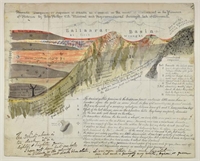
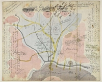
| Title | Map and sections of the goldfields of Ballaarat, Australia |
| Date | 1857 |
| Level | File |
| Extent | 2 ms sheets |
| Format | Map/section |
| Description | John Phillips (civil engineer), map and sections of the goldfields of Ballaarat, Australia, 1857. |
| Thumbnail | 
|

|

|
| Access Conditions | Access is by appointment only. Please contact the Archivist for further information. |
| Language | English |
| Publication Note | From a communication read before the Society, and published as: Phillips, J. "On the Gold-field of Ballaarat, Victoria: (Communicated by Sir R. I. Murchison, V.P.G.S.)", 'Quarterly Journal of the Geological Society', vol 14 (1858), pp538-540. |
| ArchNote | Description by John Thackray |
| CreatorName | |
| Subject | Gold deposits |
| Mining sections |
| Previous reference | LDGSL 194 |